Aerial Photography: Visual Interpretation
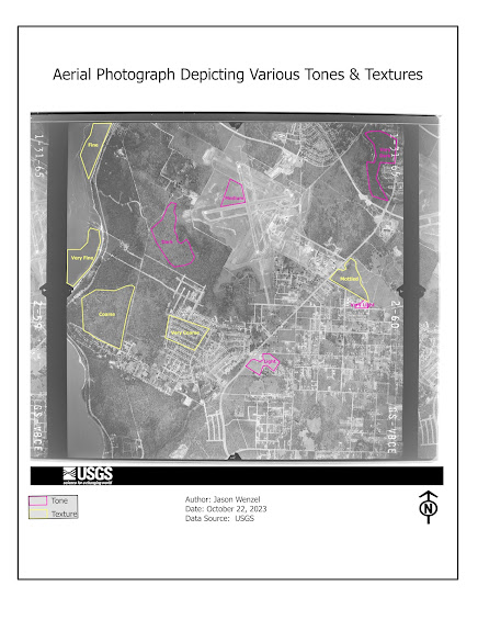
This week I started GIS 5027 (Photo Interpretation and Remote Sensing) and for the first lab assignment, we covered the basics of aerial photography, specifically visual interpretation. Here I learned how to interpret the tone and texture of aerial photographs and how to identify land features based on several visual attributes. In addition, I learned how to compare similar land features between true color and false infrared (IR) photographs. For the first part of the assignment, I created a map that shows ten areas of interest based on either tonal or textual characteristics: After this, I created another map that shows the identification of eleven different features represented by their attribute type (association, pattern, shadow, or shape-size). Examples of features included a cottage, a swimming pool, a segregated pavilion, and a street sign: I found this week's module topic and lab exercise helpful in enhancing my knowledge and skills in aerial photographic inte...