Spatial Analysis Lab
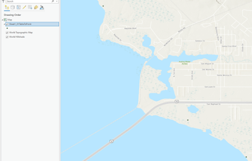
This week in GIS 5050 I completed a spatial analysis lab that involved two main tasks: adding XY data and geocoding. For the first part, I learned how to use an Excel spreadsheet to add XY values (latitude and longitude), and specifically how to convert DMS values (degrees, minutes, seconds) into decimal degrees. Below is the deliverable for the lab that is a screen capture from the map frame that shows the locations of three eagles nests in western Santa Rosa County near the shore of Escambia Bay. For the second half of the lab, I learned how to geocode addresses by copying data from an internet page, copying into, and then modifying in Excel, and then importing into ArcGIS. For this example, I geocoded the location of schools in Manatee County, Florida. I also learned how to geocode unmatched addresses by doing my own sleuthing (i.e. Google and map searches). The map shows the location of 82 schools (point file) including one university and co...