Data Quality: Fundamentals
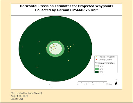
This week, I completed the first assignment in the Special Topics in GIS (GIS 5935) class. Here we learned about calculating metrics for spatial data quality in GIS, specifically understanding the difference between assessments of precision and accuracy. According to Boldstad and Manson (2022:610), "accuracy is most reliably determined by a comparison of true values to the values represented in a spatial data set." Precision, in contrast refers to "the consistency of a measurement method" (2022:612). Unlike accuracy, precision does not use a reference value but instead assesses the variance of values in the data set. In the first part of the lab, horizontal accuracy was determined from 50 waypoints mapped with a Garmin GPSMAP 76 unit , which according to the manufacturer, this device is "accurate to within 15 meters (49 feet) 95% of the time" where "users will see accuracy within 5 to 10 meters (16 to 33 feet) under normal conditions." For the...