Visibility Analysis
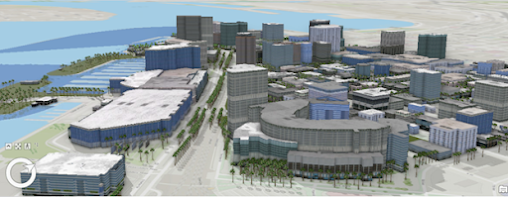
This week in GIS 5100, we learned about visibility analysis with a focus on two main types: viewshed and line of sight. As part of our assignment, we were directed to complete four different Esri courses through ArcGIS Online. This included: Introduction to 3D Visualization, Performing Line of Sight Analysis in ArcGIS Pro, Performing Viewshed Analysis in ArcGIS Pro, and Sharing 3D Content using Scene Layer Packages. For the first course, Introduction to 3D Visualization, I learned about using local and global scenes, and their differences, cartographic offset, vertical exaggeration, extrusion and applying 3D symbology, and making visual enhancements, such as displaying shadows, adjusting altitude, and ambient occlusion. For one of this course's activities, I used an ESRI authored global scene of Downtown San Diego, CA, by applying 3D symbology. Here I was able to work with shadows, illumination, time of day and ambient occlusion. This was the most interesting scen...