Electromagnetic Radiation (EMR), Satellite Sensors, and Digital Image Processing
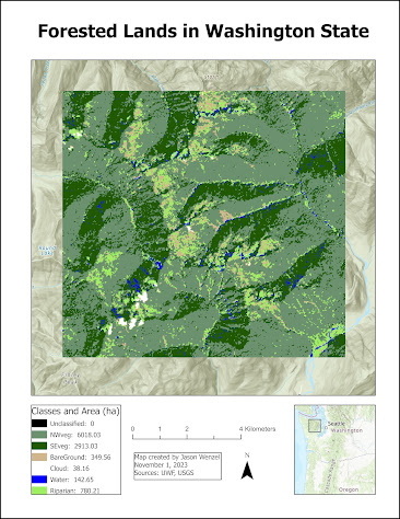
This week in GIS 5027, we covered electromagnetic radiation (EMR), Satellite Sensors, and Digital Image Processing. For the first part of the lab, I learned how to calculate wavelength, frequency and energy of EMR and use basic tools in ERDAS Imagine. I created this map from a classified image of forested lands in Washington State. By using the Inquire tool in ERDAS Imagine, I selected a subset from this and then calculated the size of each class (in hectares) via the creation of a new attribute column. After saving the subset as an output file, I imported it into ArcGIS, where I adjusted the layer's symbology with seven different classes, each showing its total area in the subset in hectares in the map's legend: For the second part of the lab, I learned about four different types of resolutions (spatial, radiometric, spectral, and temporal), their relationships with pixel and/or image size, and how to identify each in ERDAS Imagine. For the exercise, I exp...