Posts

Showing posts with the label GIS 5935

Scale, Spatial Data Aggregation, Dasymetric Mapping

Image
This week I completed the final lab for GIS 5935 which focused on scale, spatial data aggregation, and dasymetric mapping. Here I learned about the effects of scale on vector data and resolution on raster data.  In addition, we covered the effect of the Modifiable Area Unit Problem (MAUP) while using regression analysis, also known as ordinary least squares (OLS) analysis.  I also learned how to identify multipart features and measure compactness. For the first part of the lab I examined the effect of scale on vector data, in this case hydrographic polyline and polygon features from Wake County, North Carolina. Understanding the meaning of scale is important in GIS, especially how this effects resolution and extent (Goodchild 2011). I found in my analysis that t he larger the scale, the increased length of polylines, perimeter lengths, area, and number of polygons. Regarding vector data, resolution can be difficult to define and if possible it is best to use raster data for ...
Surfaces: Interpolation

Image
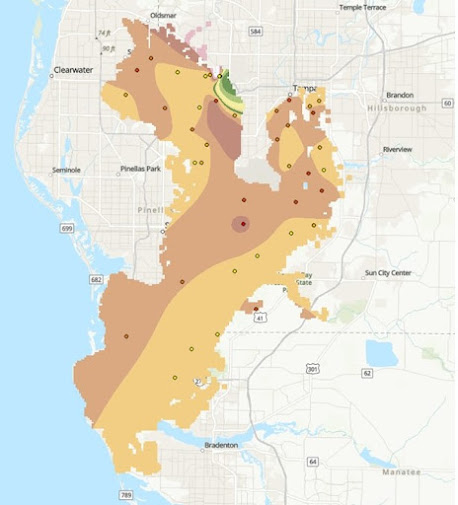
This week in GIS 5935 we continued our study of surfaces with a focus on interpolation. In this lab, I learned how to execute surface interpolation in GIS through various techniques including Thiessen, Inverse Distance Weighting (IDW), and Spline. After interpreting the results, I compared and contrasted these different techniques.  Spatial interpolation involves predicting variables at unmeasured locations based on a sample of the same variables at locations that are known (Bolstad and Manson 2022).  Interpolation is a method often used to estimate continuous variables (ratio/interval) on a variety of phenomena including temperature, soil moisture, elevation, ocean productivity, and population density (2022). Bolstad and Manson (2022:514) write "different interpolation methods will often produce different results, even when using the same input data." The first half of this lab involved creating a digital elevation model (DEM) using IDW and Spline interpolation.  The s...