Surfaces: Interpolation
This week in GIS 5935 we continued our study of surfaces with a focus on interpolation. In this lab, I learned how to execute surface interpolation in GIS through various techniques including Thiessen, Inverse Distance Weighting (IDW), and Spline. After interpreting the results, I compared and contrasted these different techniques. Spatial interpolation involves predicting variables at unmeasured locations based on a sample of the same variables at locations that are known (Bolstad and Manson 2022). Interpolation is a method often used to estimate continuous variables (ratio/interval) on a variety of phenomena including temperature, soil moisture, elevation, ocean productivity, and population density (2022). Bolstad and Manson (2022:514) write "different interpolation methods will often produce different results, even when using the same input data."
The first half of this lab involved creating a digital elevation model (DEM) using IDW and Spline interpolation. The second half involved interpolating water quality data for Tampa Bay. Here I was tasked with using a data set (for instructional purposes only) that indicated 41 different observations of pollutant concentrations in mg/L.
First, I conducted a non-spatial interpolation by using the Statistics tool in ArcGIS to determine minimum, maximum, mean, and standard deviation values. This technique was helpful in showing how statistical metrics can be inferred when a GIS system is unavailable.
Next, I used Thiessen interpolation, also known as nearest neighbor interpolation. This technique assigns a value for an unsampled location that is equal to the value found at the nearest sample location (Bolstad and Manson 2022).
After this, I used Inverse Distance Weighting (IDW), which estimates the value at unknown points using the samples values and distance to nearby points; essentially the weight of each sample point is an inverse proportion to the distance (Boldstad and Manson 2022).
The final technique used was Spline, which is used to interpolate values along a smooth curve by essentially "forcing a smooth line to pass through a desired set of points" (Boldstad and Manson 2022: 522). I used two different types of Spline: Regularized and Tension. The Regularized option produces smoother surfaces than those created with the Tension option; the Tension option on the other hand uses higher values entered for the weight parameter, thus giving a coarser surface (ESRI 2023).
The technique that produced the best visualization of BOD concentrations was with the Spline technique. The output produced by this method appears more natural given that pollution could emanate from specific locations and diffuse in a particular pattern but not be so “nested” as the IDW output showed. When looking at certain parts of the landscape, like inlets, roads, dense urban areas, etc., the interpolated pollution values visualized via the Spline method does not look as artificially-derived as IDW.
One of the issues with the Spline-Regularized, however, is that areas of high (or low concentration) may appear when there are no surrounding data points. This, however, was corrected with the Tension option.
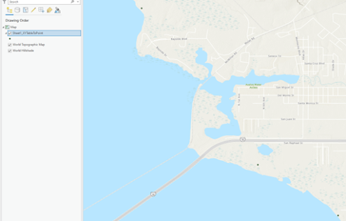
The image below shows a screenshot of interpolated BOD concentrations from the Spline-Tension technique:

Overall, I found this week's module interesting but also challenging. I enjoyed learning about the ways in which values can be spatially interpolated from point features by using various techniques. I had briefly learned about some of the concepts and techniques in previous courses but not to the extent of what was covered in this class. I appreciate the opportunity to expand my knowledge and skills in GIS in this area. I could envision using spatial interpolation for cartographically assessing a variety of continuous data in my field such as ancient and historic patterns of human land use as well as climate, soil fertility, hydrology, floral and faunal distributions, and many more variables.
2023 ESRI
Spline (Spatial Analyst). https://pro.arcgis.com/en/pro-app/latest/tool-reference/spatial-analyst
/spline.htm
2022 Bolstad, Paul and Steven Manson
GIS Fundamentals: A First Text on Geographic Information Systems, 7th edition. Minnesota: Eider
Press.


Comments
Post a Comment