Georeferencing Lab
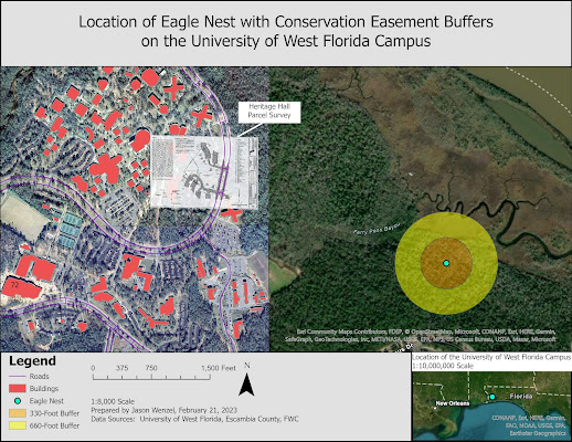
Today I completed my last weekly lab for GIS 5050 where I learned about georeferencing, editing, and creating 3D models. This was probably the most time intensive lab of the six though I did not necessarily find it that difficult in terms of getting stuck on a specific task. The lab just took a while to complete. For the first exercise, I created a map that shows the University of West Florida campus in relation to an eagle nest immediately to the east in a forested area. For this task, I created a multi-ring buffer with color-coded 330 and 660 foot conservation easement buffers. In addition, I digitized two campus features from the raster: Building 72 and Campus Lane. I also georeferenced the survey plat for Heritage Hall by using control points, monitoring RMS values, and doing a polynomial transformation. For the second task, I used some of the same elements and tasks from the previous one but created a 3D model of the UWF campus. I converted...