Image Preprocessing: Spatial and Spectral Enhancements and Band Indices
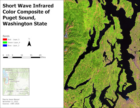
This week in GIS 5027, we learned about image preprocessing, specifically how to apply spatial enhancements for imagery use, and how to view the properties of multispectral imagery and create band indices. For the main part of the assignment I prepared maps of three different features in the vicinity west of the greater Seattle, Washington area, each using a different band combination. Working with the ERDAS Imagine software, and following the lab instructions, I identified these features from a LANDSAT Thematic Mapper derived image by following four steps: 1. Examined the histogram for shapes and patterns in the data. 2. Visually examined the image as grayscale for light or dark shapes and patterns. 3. Visually examined the image as multispectral, changing the band combinations to make certain features stand out. 4. Used the Inquire Cursor to find the exact...