Posts

Showing posts from November, 2023

Unsupervised and Supervised Image Classification

Image
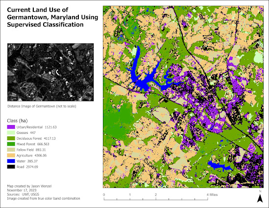
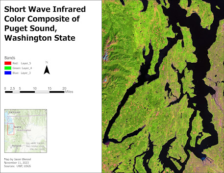
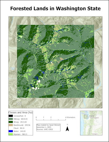
This week in GIS we covered unsupervised and supervised image classification where we conducted digital image processing in ERDAS Imagine software to collect and evaluate spectral signatures from satellite imagery. For the first part of the assignment, I conducted an unsupervised classification of surface types from a high resolution aerial photograph of the UWF campus in order to determine the amount of coverage of permeable vs. nonpermeable areas. For the the second part of the assignment, I conducted a supervised classification of land use of Germantown, Maryland based on a true color satellite image: Overall, I enjoyed completing this week's assignments and found the skills and techniques I learned helpful in expanding my proficiency in GIS.

Image Preprocessing: Spatial and Spectral Enhancements and Band Indices

Image
This week in GIS 5027, we learned about image preprocessing, specifically how to apply spatial enhancements for imagery use, and how to view the properties of multispectral imagery and create band indices. For the main part of the assignment I prepared maps of three different features in the vicinity west of the greater Seattle, Washington area, each using a different band combination. Working with the ERDAS Imagine software, and following the lab instructions, I identified these features from a LANDSAT Thematic Mapper derived image by following four steps:     1. Examined the histogram for shapes and patterns in the data.     2. Visually examined the image as grayscale for light or dark shapes and patterns.     3. Visually examined the image as multispectral, changing the band combinations to make certain         features stand out.      4.  Used the Inquire Cursor to find the exact brightness value of a particular area. The first map shows a short wave infrared color composite of Pug

Electromagnetic Radiation (EMR), Satellite Sensors, and Digital Image Processing

Image
This week in GIS 5027, we covered electromagnetic radiation (EMR), Satellite Sensors, and Digital Image Processing. For the first part of the lab, I learned how to calculate wavelength, frequency and energy of EMR and use basic tools in ERDAS Imagine.   I created this map from a classified image of forested lands in Washington State.  By using the Inquire tool in ERDAS Imagine, I selected a subset from this and then calculated the size of each class (in hectares) via the creation of a new attribute column. After saving the subset as an output file, I imported it into ArcGIS, where I adjusted the layer's symbology with seven different classes, each showing its total area in the subset in hectares in the map's legend: For the second part of the lab, I learned about four different types of resolutions (spatial, radiometric, spectral, and temporal), their relationships with pixel and/or image size, and how to identify each in ERDAS Imagine.  For the exercise,  I explored additional