Data Quality: Standards

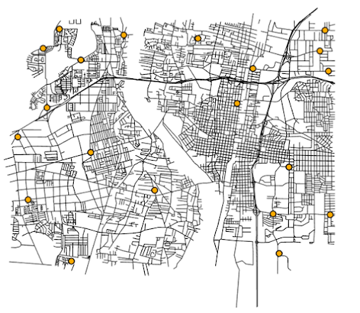
This week in GIS 5935 we continued our study of data quality in GIS with a focus on standards. This included metrics for assessing positional accuracy via standards such as the National Map Accuracy Standards (NMAS) and the National Standards for Spatial Data Accuracy (NSSDA). Positional accuracy is one of the five components of data quality with the others being attribute accuracy, logical consistency, completeness, and lineage. For this module's lab assignment, I assessed positional (horizontal) accuracy for two different polyline layers of streets in a section of Albuquerque, New Mexico. This included a shapefile of road centerlines from the City of Albuquerque and another file of a sample of the same study area from StreetMap USA, a TeleAtlas product distributed by ESRI with ArcGIS. For the assignment, I created three different point shapefiles. Two were directly produced from a sample of 20 different intersections of streets in the previously mentioned polyline files. T...
