Posts

Showing posts from September, 2023

Surfaces: Interpolation
Image
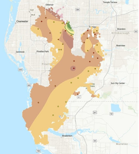
This week in GIS 5935 we continued our study of surfaces with a focus on interpolation. In this lab, I learned how to execute surface interpolation in GIS through various techniques including Thiessen, Inverse Distance Weighting (IDW), and Spline. After interpreting the results, I compared and contrasted these different techniques.  Spatial interpolation involves predicting variables at unmeasured locations based on a sample of the same variables at locations that are known (Bolstad and Manson 2022).  Interpolation is a method often used to estimate continuous variables (ratio/interval) on a variety of phenomena including temperature, soil moisture, elevation, ocean productivity, and population density (2022). Bolstad and Manson (2022:514) write "different interpolation methods will often produce different results, even when using the same input data." The first half of this lab involved creating a digital elevation model (DEM) using IDW and Spline interpolation.  The s...
Surfaces: TINs and DEMs

Image
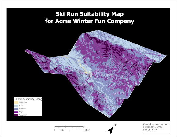
In this week’s lab, we learned about the use of surfaces in GIS, specifically creating, editing, and analyzing TINs and DEMs. Through the assignment, I was able to create 3D visualizations of elevation models, use various input data sets to create and modify TINs, and compare the properties and derivatives of TIN and DEM elevation models.  TIN is abbreviated for triangulated irregular network; it is one model that is used to represent surfaces including elevations, through a combination of point, line, and area features (Boldstad and Manson 2022:40). DEM refers to digital elevation model or digital terrain model (DTM) and it is commonly used for terrain analysis (2022:66). TINs are essentially a DEM but in the form of vector-based data whereas other DEMs can be derived through a raster grid.  One of the drawbacks of TINs, however, is that they are less widely available than raster surface models, and tend to be more expensive to build and process because of the complex data st...