Posts

GIS Portfolio

Image
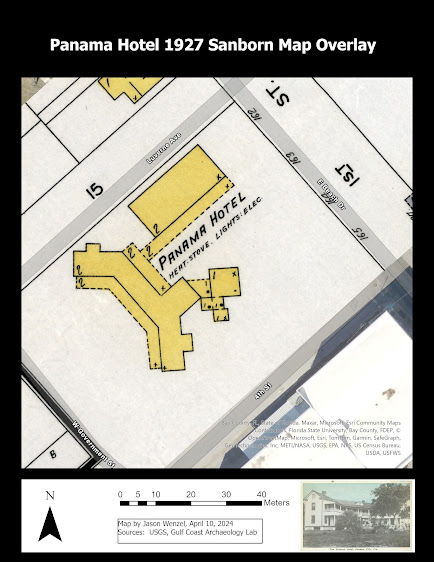
I am proud to present my portfolio , which fulfills GIS Internship (GIS 5945), my final course for the graduate certificate in Geographic Information Science (GIS) at the University of West Florida (UWF).  This may be the last entry to this blog, at least during the remainder of my time in the program. In this entry I will provide highlights from my portfolio and what I accomplished for the GIS internship along with some final thoughts on the program. The primary goals for the internship related to my work as a professor at Gulf Coast State College (GCSC) in Panama City, Florida.  These involved: developing a World Regional Geography with GIS course, producing site maps for GCSC archaeological research projects, and conducting basic spatial analysis. I shared information on progress on the first task in a previous entry (February 29, 2024), so here I will discuss the last two. In the Spring 2015 semester, GCSC offered its first Introduction to Archaeology (ANT 2100) course, an...
GIS Day

  I created my own “GIS Day” with two different events:  the first involved incorporating information on GIS into class lessons for my Principles of Sociology course and sharing information on GIS with my faculty colleagues.  For the first activity, I had the students explore the relevance of GIS to the field of sociology by finding examples of studies or projects aimed at using this technology in responding to societal needs. One student presented an example of how GIS could be used in post-disaster assessment, in this case, hurricanes, and another wrote about how GIS could be used in disaster management, particularly during a wildfire event.  Another wrote about the value of GIS in determining flood risks for specific locations. In addition, I took the class over to GCSC’s Technology Center for Emergency Response and UVS to meet with director Mike Shekari.  Professor Shekari discussed how his lab uses GIS for many tasks, such as mapping debris fields followi...

GIS and Curriculum Development

Image
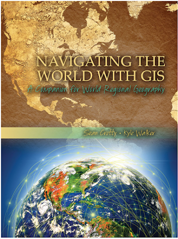
For part of my internship activities, I am developing curricular materials for use in World Regional Geography, a course currently proposed to be offered by Gulf Coast State College starting in Fall 2024 that I anticipate teaching. I have an interest incorporating GIS into class lessons and student assignments, and I have been exploring Navigating the World with GIS:  A Companion for World Regional Geography (2015) by Sean Crotty and Kyle Walker. I may assign this text as a companion along with  Finlayson's World Regional Geography . Crotty and Walker's book includes nine chapters each with its own exercise. Topics include global population change, aging in Europe, political and ethnic geography in the former Soviet Union, segregation in North American cities, economic inequality and migration in Mexico, social and spatial context for the 2014 World Cup, combating Malaria in Ghana, electoral geography and the 2014 Lok Sabha elections, and mapping maritime disputes in the So...

Readings for GIS Internship

Image
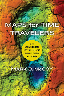
To support my internship, I ordered three books that I believe will be helpful in guiding my research and GIS-related activities. Maps for Time Travelers (2022) by Mark D. McCoy, professor of anthropology at Florida State University, is a recent book that provides a brief, but comprehensive exploration into the ways that archaeologists use geospatial technologies, particularly GPS, GIS, and various remote sensing techniques in the study of the human past.  In this work, McCoy provides an overview of the use of these technologies by archaeologists from early studies over a century ago up through the present time.  He discusses how these technologies can be used to understand human patterns of migration, food procurement and production, and how ancient societies can be "reversed engineered" through these approaches. While I am familiar with many of the technologies discussed in the book and some of the cases studies where they have been applied, this work serves a good refresh...

Internship Introduction and GIS Community

This semester I am excited to begin, GIS 5945:  Internship, which is the final course required for the Graduate Certificate in GIS at UWF. At the completion, I expect to have enhanced my knowledge and skills in using ArcGIS Pro software while incorporating basic principles of geography,  and local contextual archaeological and historical data to support GIS analysis. Key learning goals for the internship include: 1. Explore the distribution of geography/GIS courses taught in the Florida College System and preparing for teaching in geography with GIS at Gulf Coast State College. 2. P roduce maps for archaeological sites using ArcGIS that were studied by Gulf Coast State College. 3.   L earn how to conduct spatial analysis of archaeological data using ArcGIS. This week for the internship, I updated my C.V. to reflect some of the competencies in GIS I have obtained while taking courses in the certificate program.  In addition, I was directed to join a GIS user...

Remote Sensing Final Project

Image
I finished GIS 5027 with a final project that examined land use land cover (LULC) changes in South Lake Tahoe, California. I investigated changes in the distribution of impervious surface areas to assess the extent of urbanization by comparing European Space Agency (ESA) Sentinel-2 mission satellite data from 2016 and 2023. By using ERDAS Imagine and ArcGIS software, I created two final maps reflecting the work completed on my project.  The first map shows LULC derived from supervised image classification of the 2023 image of five distinct classes of landcover (Buildings, Forest, Lakes, Roads, and Wetlands).   It is estimated from this subset image that impervious surface comprises 42.4%, excluding the areas identified as “Lakes”:   The second map includes a false color urban RGB composite of the same 2023 subset image. This uses a combination of Bands 12, 11, and 4 displayed as R-G-B respectively. It clearly makes the vegetation (pervious surface) stand out in green from...