Remote Sensing Final Project
I finished GIS 5027 with a final project that examined land use land cover (LULC) changes in South Lake Tahoe, California. I investigated changes in the distribution of impervious surface areas to assess the extent of urbanization by comparing European Space Agency (ESA) Sentinel-2 mission satellite data from 2016 and 2023. By using ERDAS Imagine and ArcGIS software, I created two final maps reflecting the work completed on my project.
The first map shows LULC derived from supervised
image classification of the 2023 image of five distinct classes of
landcover (Buildings, Forest, Lakes, Roads, and Wetlands). It is estimated from this subset
image that impervious surface comprises 42.4%, excluding the areas identified
as “Lakes”:
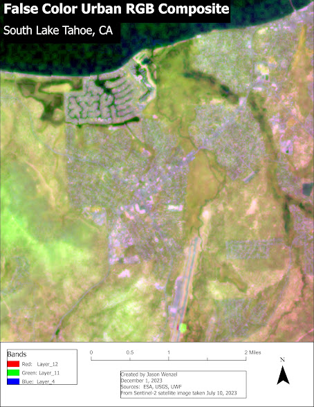
The second map includes
a false color urban RGB composite of the same 2023 subset image. This uses a
combination of Bands 12, 11, and 4 displayed as R-G-B respectively. It clearly makes the vegetation
(pervious surface) stand out in green from the urban area (impervious surface)
in white, gray, and purple:


Comments
Post a Comment