Vector Analysis Lab
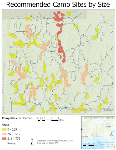
This week in GIS 5050 we had our vector analysis lab, where I learned about how vector data is stored, and to do buffer analyses, joins and unions, code attributes, and do some more advanced analysis over the previous labs. For this week, I created the map below at an area in Mississippi that shows recommended camp sites by size (hectare) in areas that are not too close or too far from water, and away from roadways that do not overlap with conservation areas. Overall I felt that I achieved success with the project and found it helpful in strengthening my GIS analytical skills.


Comments
Post a Comment