Projections Lab
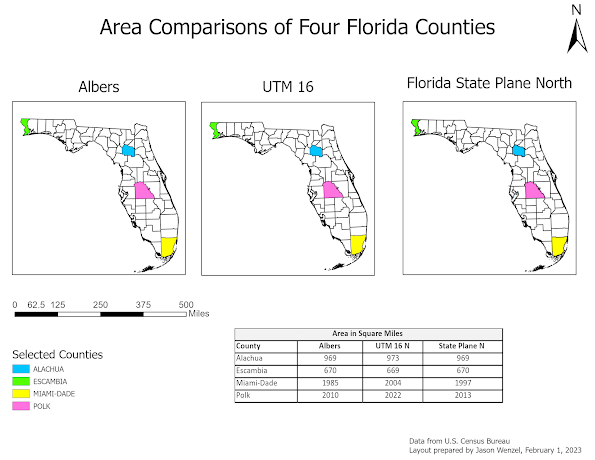
This week in GIS 5050, I completed two different labs: ArcGIS field maps and projections. For the later, I created a layout showing area comparisons for four different Florida counties on three map frames each with three different projections-Albers, UTM 16, and Florida State Plane North. This lab was helpful in reinforcing basic GIS/ArcGIS skills (retrieving data, using map and layout frames, symbolizing, exporting, etc.) This lab was also helpful in enhancing and expanding my understanding of the way projection coordinate systems work, and how they are different from geographic coordinate systems. While the lab took some time, and a few steps took some effort to figure out and work through, overall, I had much success and am happy of my progress and results. I'm ready for what next week's lab will bring! :)


Comments
Post a Comment